
Capture
Capture is one of the core building blocks of Feldy. Photos, videos, AI Job Walkthroughs, and 3D scans create a structured record of what is happening at the jobsite. Every capture is associated with a specific project, allowing field and front-office teams to work from the same information.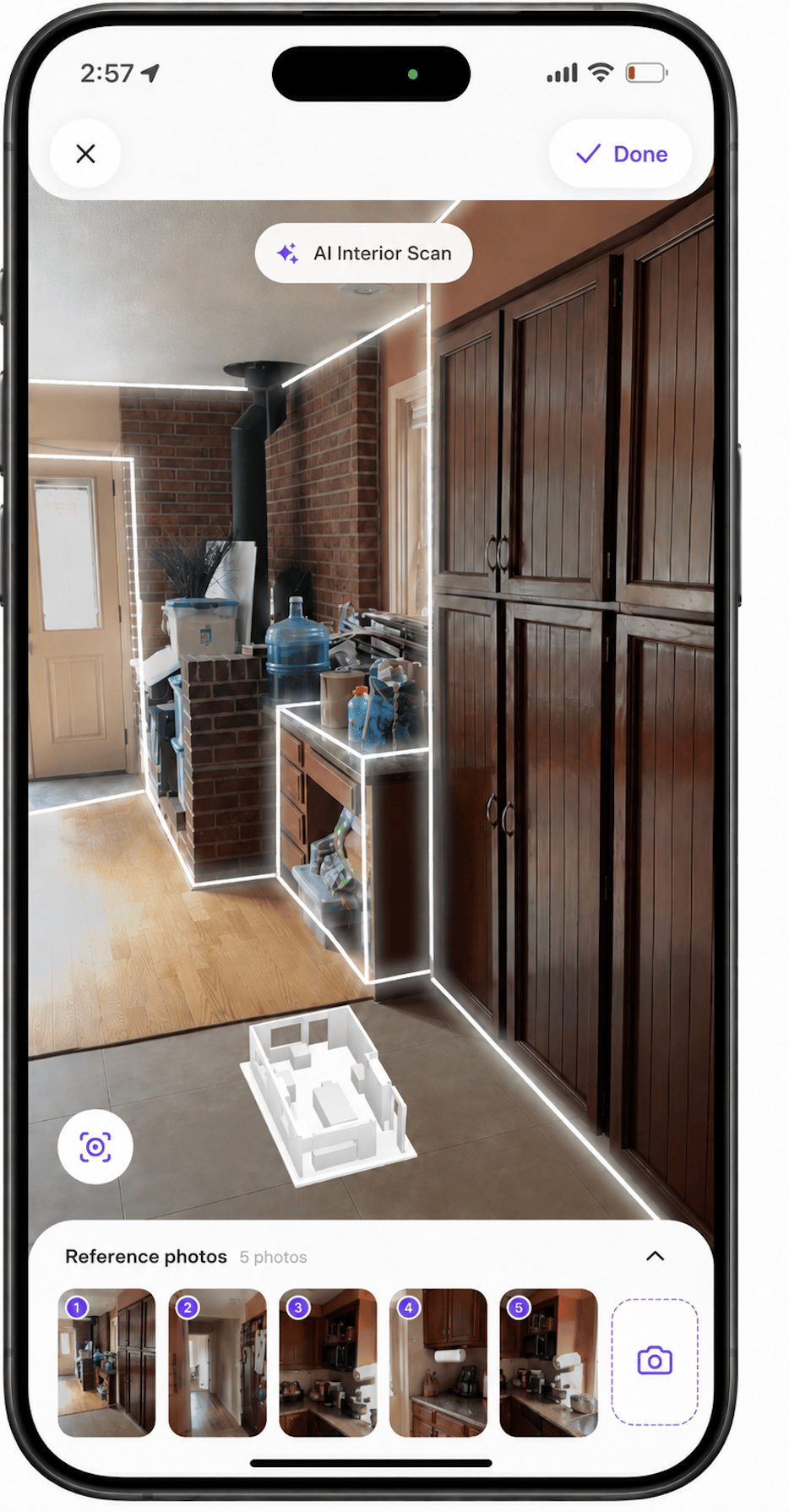
- AI estimates
- Scopes of work
- Project documentation
- Inspection reports
- Measurement reports
- Customer-facing proposals
- Internal notes and summaries
- Before, progress, and completion records
Types of capture
A Feldy project can contain several types of jobsite capture.Photos
Photos document individual areas, materials, conditions, damage, and completed work. They are useful for showing:- The overall work area
- Existing materials and finishes
- Damage or deterioration
- Areas included in the scope
- Access limitations
- Work in progress
- Completed work
- Customer requests or selections
Videos
Videos provide additional context when one image cannot fully communicate the space or condition. Use video to document:- Large or connected spaces
- Multiple elevations or rooms
- Movement through a property
- Complex jobsite conditions
- Access routes
- Damage that is difficult to show in a still photo
- How different areas relate to one another
AI Job Walkthroughs
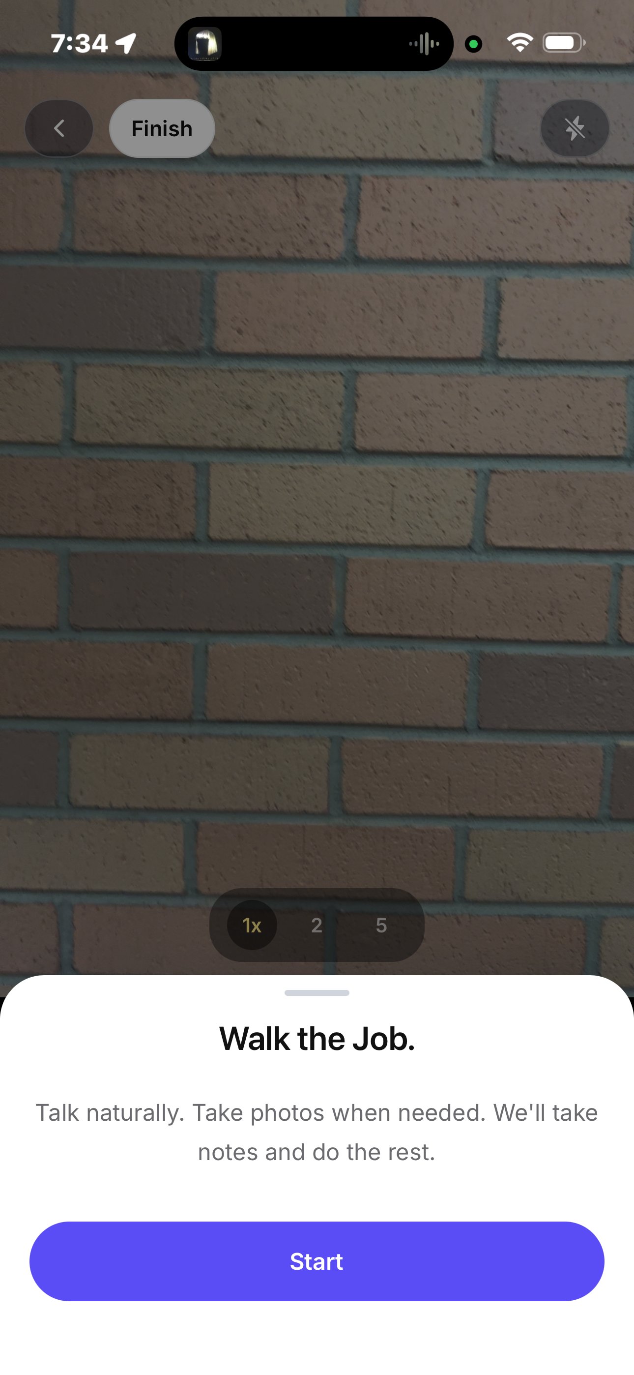
AI Job Walkthroughs combine jobsite captures with spoken or written context. A field team member can move through the property, show the relevant work areas, and explain what they are seeing. Feldy can then use the walkthrough as a source for estimates and project documentation. AI Job Walkthroughs are useful when the person capturing the jobsite has context that cannot be understood from photos alone.3D interior captures
A 3D interior capture uses a supported phone’s LiDAR sensor to scan the room and create a structured spatial model. Feldy can currently use interior captures to provide:- Floor measurements
- Wall measurements
- A simplified 3D representation of the space
- Room-layout information
- Spatial context for estimating and documentation
Capture on the web
The Photos area in the Feldy web application gives the front-office team a live view of captures being added from the field. As field users take photos, record videos, complete AI Job Walkthroughs, or perform supported scans, the captures are uploaded to their associated projects and become available to office users. This allows estimators, managers, and coordinators to begin reviewing the job without waiting for the field team to return to the office.Photos by project
Select Photos from the left navigation to open your organization’s capture library. The Photos by project view groups captures according to the project they belong to. Each project card may display:- A recent project image
- The project name
- The property address
- The team member who captured the media
- The number of captures associated with the project
All photos
Select All Photos to browse individual images across every project you can access. This view is useful when you want to review recent field activity without opening projects one at a time. The Photos area allows the front-office team to quickly understand:- Which projects were recently visited
- What was captured at the property
- Which team member performed the capture
- Whether additional documentation is needed
- Whether estimating or documentation can begin
Open a capture
Select a photo to open the capture viewer. The viewer displays the full image alongside the information connected to it. Depending on the capture, this may include:- Capture name
- Description
- Property address
- GPS location
- Team member who uploaded it
- Date and time captured or updated
- Labels
- Comments
- A link to the associated project
Property and GPS information
Captures remain associated with the project and property where they were recorded. When location data is available, Feldy displays the GPS information alongside the capture. This helps the office team confirm where the media was recorded and reduces the chance of a capture being associated with the wrong project. GPS availability depends on the mobile device’s permissions and the information recorded when the capture was created.See who captured the work
Feldy records the team member associated with each capture. This gives the front-office team a record of:- Who visited the property
- Who documented a particular condition
- Who may have additional context
- When the capture was added
Organize captures with labels
Labels help teams categorize jobsite media. Examples include:- Existing damage
- Before work
- Work in progress
- Completed work
- Roof
- Siding
- Flooring
- Kitchen
- Customer request
- Change order
- Needs review
Add comments
Front-office team members can add comments directly to an individual capture. Comments remain attached to the specific photo or video, keeping the conversation connected to the condition being discussed. For example:Can you take another photo showing the entire cabinet wall and the exposed side panel?Or:
Please confirm whether the damaged siding continues behind the downspout.Comments help field and office teams resolve questions while the field representative is still at the property.
Go to the associated project
Select Go to project from the capture viewer to open the complete project record. From there, you can review:- Customer and property information
- All project captures
- AI Job Walkthroughs
- Measurement reports
- 3D models
- Estimates
- Proposals
- Documents
- Notes and project activity
How Feldy uses captures
Captures give Feldy the visual and spatial context needed to understand physical work. When generating an estimate or document, Feldy can use selected captures together with:- Written instructions
- AI Job Walkthroughs
- Measurement reports
- Uploaded documents
- Organization pricing
- Estimate templates
- Pricebook rules
Capture from the mobile app
The Feldy mobile app is where field teams create most jobsite captures. From the mobile app, users can:- Take photos
- Record videos
- Complete AI Job Walkthroughs
- Perform supported 3D scans
- Review captured media
- Add context from the field
- Upload captures to the project
Open a project
Before taking a capture, open the project associated with the property. You can open a project from:- The Home screen
- The Projects list
- The Photos area
- A favorite project
- A recent project card
Take project photos
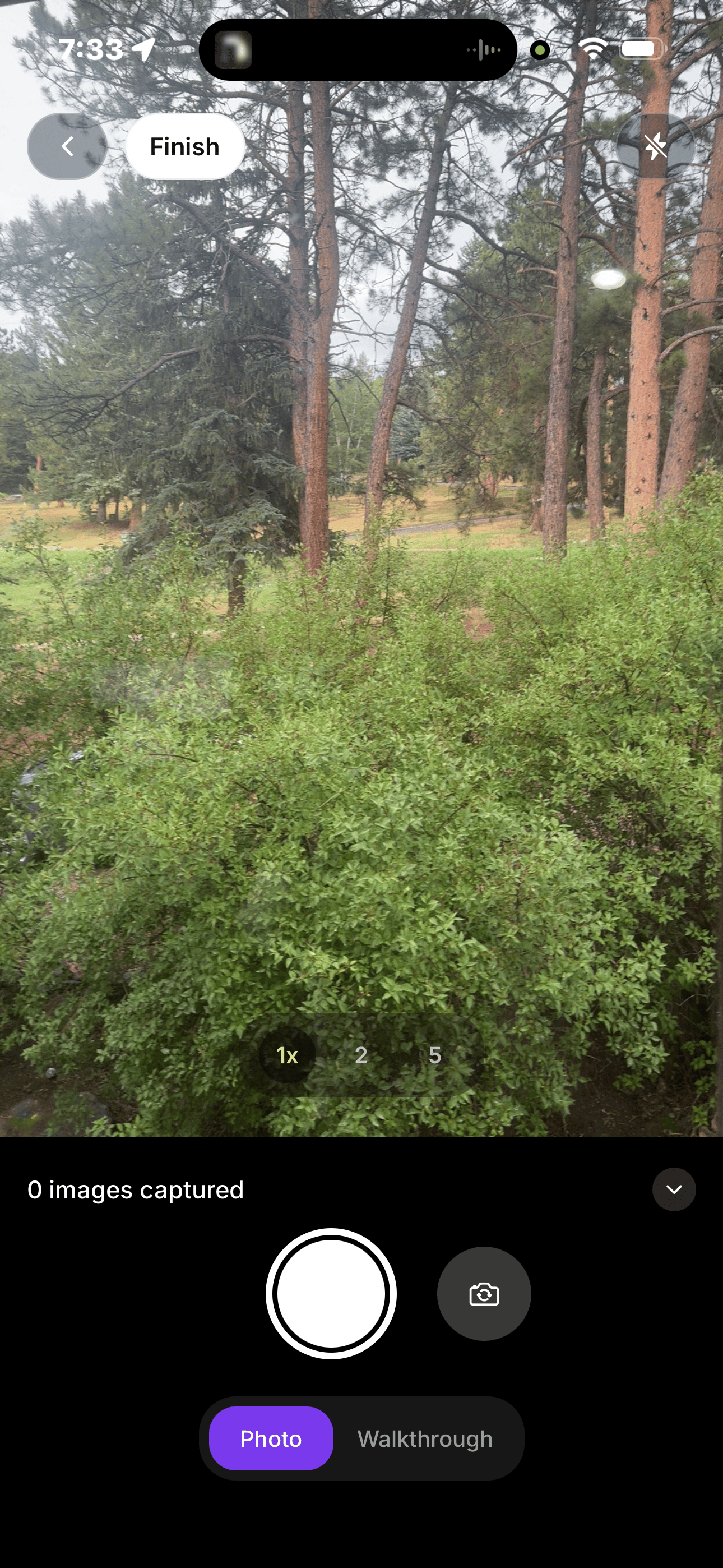
From the project, select the camera button. Take clear photos that show the work area from multiple angles. Start with wide photos that establish the overall layout. Then move closer to document materials, damage, details, and conditions that may affect the scope or price. For the best results:- Keep the camera steady
- Make sure the area is well lit
- Avoid covering the camera lens
- Capture the complete work area
- Avoid cutting off important surfaces
- Take close-ups of damage or special conditions
- Capture obstacles or access limitations
- Review the photos before leaving the property
Record video
Use video when movement through the space provides important context. Move slowly and steadily while recording. Show how the different work areas connect, and avoid turning the phone too quickly. Video is especially useful for:- Large properties
- Connected rooms
- Exterior elevations
- Complex damage
- Access routes
- Areas that are difficult to explain with photos
Complete an AI Job Walkthrough
Use an AI Job Walkthrough when you need to show the space and explain the work at the same time. As you move through the jobsite, describe:- What work is being requested
- Which areas are included
- Existing damage or conditions
- Materials and finishes
- Customer preferences
- Access limitations
- Cleanup or disposal requirements
- Anything that should be excluded
Review captures before leaving
Before leaving the jobsite, review the project and confirm that:- Every relevant area was captured
- The photos and videos are clear
- Existing conditions are visible
- Important details have close-up images
- The correct project was selected
- Additional context has been added where necessary
- Office-team questions have been addressed
3D interior capture
3D interior capture is another form of jobsite capture available in Feldy. Using a supported LiDAR-equipped mobile device, field teams can scan an interior space while walking through it. Feldy detects the room geometry and creates a structured 3D representation of the captured area. During the scan, outlines appear around detected walls, floors, openings, cabinets, and other major surfaces. A live model preview helps confirm that the space has been captured before the scan is completed.What interior capture provides
Interior capture currently allows teams to:- Create a 3D model of an interior space
- Measure floor areas
- Measure wall areas
- Understand the room layout
- Preserve spatial information with the project
- Use captured measurements to support estimates
- Use the model as supporting project documentation
- Flooring
- Interior painting
- Remodeling
- General contracting
- Restoration
Supported devices
Interior capture requires a supported mobile device equipped with LiDAR. The capture option may not appear on unsupported devices or for organizations that have not been given access.Capture an interior space
To complete an interior scan:- Open the relevant project in the Feldy mobile app.
- Start an Interior 3D Capture.
- Slowly move through the room while pointing the device toward the walls, floor, openings, and major features.
- Continue until the visible outlines show that the required space has been captured.
- Select Done.
- Review the generated 3D model.
- Select Complete to save the capture to the project.
Review the 3D model
After completing the scan, Feldy generates a simplified 3D representation of the space. Review the model and confirm that:- All required walls are present
- The floor area appears complete
- Openings and room transitions are represented
- The entire work area was captured
- No major section of the room is missing
- The resulting layout reasonably matches the physical space
Measurements
Interior capture currently focuses on:- Flooring measurements
- Wall measurements
Limited availability
Interior 3D capture will be available only to selected Feldy accounts until September 1, 2026. To request access, email support@feldy.ai and include:- Your company name
- Your Feldy account email
- Your primary trade
- The type of interior work you want to capture
- The supported LiDAR device your team uses